
keine Informationen
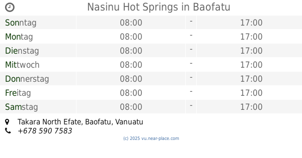
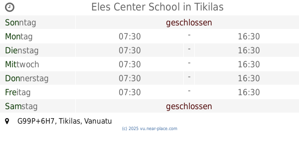
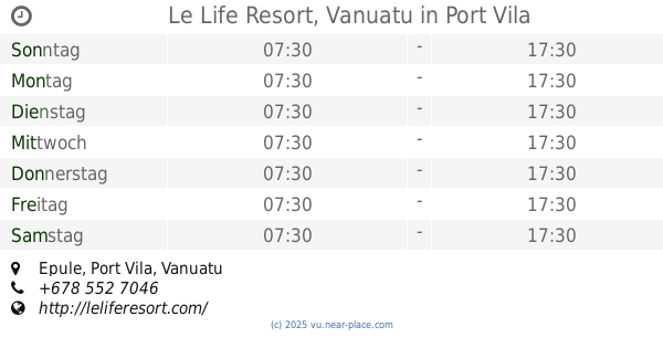
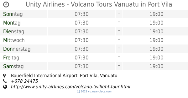
🕗 öffnungszeiten
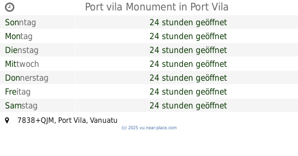
| Sonntag | ⚠ | |||||
| Montag | ⚠ | |||||
| Dienstag | ⚠ | |||||
| Mittwoch | ⚠ | |||||
| Donnerstag | ⚠ | |||||
| Freitag | ⚠ | |||||
| Samstag | ⚠ | |||||
Efate, FC98+72C, Napara, Vanuatu
kontakte telefon: +687 77.72.05
webseite: www.facebook.com
größere karte und wegbeschreibungLatitude: -17.5318023, Longitude: 168.4150104


John Clark
::Closed.diapointed.dont bother
Lucas Tuckwell
::The underwater wreck is a WW2 Corsair and is located at (lat -17.527772° and long 168.420942°). Put this is in Google Earth and you can actually see the aircraft. Apparently is crashed on approach to the airstrip at Baofatu. The wreck at the water line next to the mangroves is also a WW2 Corsair and is located at (lat -17.528081° and long 168.415251°). You used to be able to hire a guide from the WW2 Relics Museum to take you out to both in a tinny but I'm not sure if that is still the case.